


1. How to measure distances between points
Make: map
Model / Product: Maps
Version: n/a
Objective / Info: Use Google Maps to measure the distance between two points. maps.google.com
Model / Product: Maps
Version: n/a
Objective / Info: Use Google Maps to measure the distance between two points. maps.google.com
1
Visit Google maps at maps.google.com. You will need to add a feature Google Labs to make this work.2
After you log into the Google Maps account, click the "New" icon in the upper right hand corner of the site.

3
Locate the "Distant Measurement Tool" and select the "Enable" option next to it. Click the "Save changes" button.
4
You should now see a new small icon in the lower left hand corner of Google Maps.
5
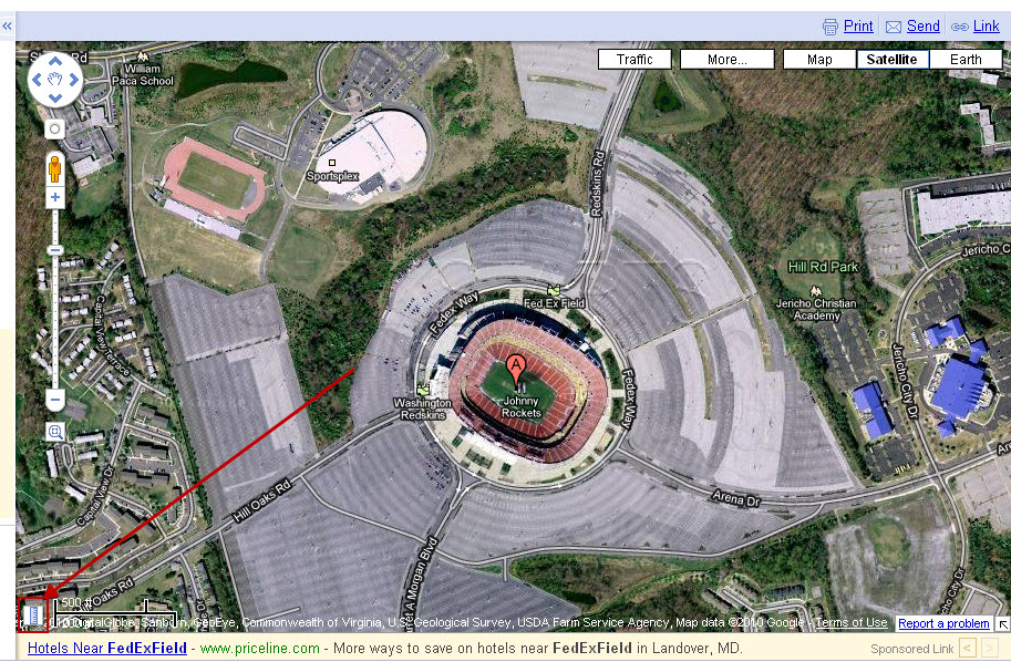
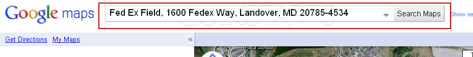
Locate one of the spots on Google maps that you want to measure by placing the address in the search box.
6
Click the new icon in the lower right hand corner.

7
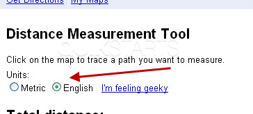
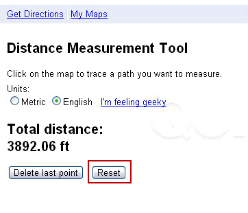
You can select "English" to show units in feet / miles.
8
Locate your second point and left click. You should see a red circle with a black square. The number on the left should change from zero to a new number.

9
Left click to pin the starting point of the distance you want to measure. The result is a tiny green arrow with a black triangle and a reading of 0 ft to the left.
Note :
You cannot plant the pin on top of an existing pin.

10
You can left click multiple times until you reach your final destination. Note :Press the "Delete" button to delete the last point added.
11
Press the "Reset" button to remove all of the points.
comments powered by Disqus
 Ask a question or provide an answer